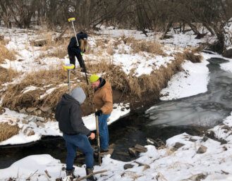
Our funding will support streambank assessments on four of the most polluted sub watersheds of the Fox River. These watersheds flow directly into Lake Winnebago and are significant contributors to the high phosphorus and nitrogen levels found there. FWWA will use GIS data and modeling to predict streambank erosion. They will then survey up to 25 percent of the stream miles to ground truth and improve the model. If successful, this modeling will allow the remaining 28 sub-watersheds in the Lake Winnebago area to have stream bank analysis done much more efficiently.