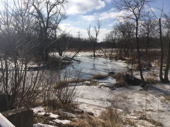
This project will transform 1,300 feet of the Little Menomonee River and eight acres of wetland in one Ozaukee County’s highest priority areas, as identified by the county’s Ecological Prioritization GIS Tool. The finished project will include 1,900 feet of meandering stream; replacement of a failing culvert; and creation of 4.2 acres of floodplain wetland, 1.5 acres of emergent marsh, 1.7 acres of open water wetland, and .37 acres of wooded ephemeral pond. These wetlands will store and treat stormwater runoff from adjacent lands to improve water quality, improve baseflow rates in the river, and reduce flooding and erosion risk downstream.
Ozaukee County has a history of successful stream and wetland restorations.
